Thursday 19 November 2020

(Mis)adventures in the hills

I am lucky to be alive.

It was raining heavily after two fine days on an eight-day backpacking trek in the Highlands of Scotland. 10:30am saw me carefully descending the steeply incised, twisting track down the old drove road in Allt an Tomain Odhair between Glenelg and Kinloch Hourn. At the ford at grid ref NG906105 I was swept violently off my feet by a tributary of the main river.

I had to let go my pack with all my gear and lost everything except what I was wearing. Luckily much of that was my trusty Paramo gear: Cascada trousers, Velez Adventure Light jacket and waterproof storm cap. I firmly believe that this stalwart, effective gear played a big part in my survival on that day.

This is the story of that trip, the risk assessments I made, the decisions I took and the struggles I made to get back to safety.

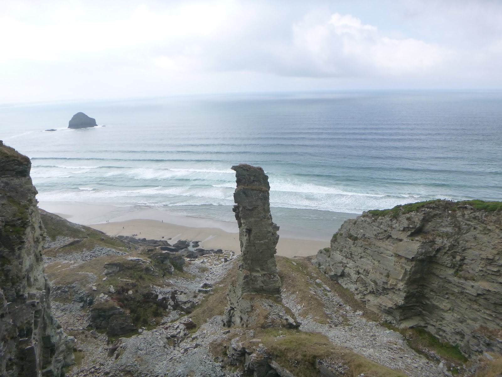
The site of the misadventures. Thank you to MemoryMaps

In May 2020 I was due to take part in the annual crossing of Scotland from the west coast to the east coast known as The Great Outdoors Challenge (TGOC20) which would have taken me just short of a fortnight. Because of the Covid-19 (C19) pandemic this had been cancelled. Other than odd day walks, I had not been able to have a ‘proper’ backpack in the hills. Having been stood down by work for 6 months, with no prospect of an end, cabin fever had set in. Come September I decided that when the midge season was over, I would take just over a week to walk the first sections of my TGOC20 route so I upped my training and made preparations for a mid-October trip. With increasing cases of C19 across the country, I knew that I needed to get out into the hills soon if I was going to have the break that I needed so badly before we got locked down again.


Starting from Shiel Bridge I had a glorious first couple of days, walking to the coast at Glenelg, then easterly up Gleann Beag, picking up the south easterly ‘powerline path’ heading towards Kinloch Hourn. This was what I had dreamed about all year. I took photos, dawdled to look at interesting archaeology and fascinating rocks. I listened to the stags roaring and searched the hillsides to find them with my little monocular. I didn’t mind that I had got a bit behind my planned schedule – I had all of next week to catch up. I was where I wanted to be, high in the hills.


On my second night, I had settled into the routine of walking and leave-no-trace wild-camping, so I slept really well, pitched high on the hills not far from a tiny stream.  Overnight, while I slept heavily, a storm blew in. On Monday morning I woke (about an hour later than I had planned) to the tumultuous sounds of high winds and heavy rain. Not overly concerned, although disappointed not to have a fine day like the previous two, I breakfasted, struck camp and set off on my way, following the powerline path downhill.


Although the weather had deteriorated considerably, I was wearing my Paramo wet-weather gear, so I wasn’t unduly concerned. It was very wet underfoot, and lots of small streams had become fast flowing torrents. As I looked around, I could see white ribbons of water cascading down the hills around me.  I knew I had rivers to cross in the next stretch and began to get apprehensive about the conditions I would meet.


As I dropped down into the glen of the Allt an Tomain Odhair I was more sheltered among the trees. The track, although loose underfoot, was obviously travelled frequently and bore the signs of off-road vehicles. It twisted and dropped savagely into a narrow incision. Hemmed in, I rounded a corner and was met by fast flowing water at a ford. I stopped and took a good look. The track continued quite clearly on the far side. Not good. Crossing water courses is the most dangerous thing we do as hillwalkers. I climbed back up the hill a bit to find a spot where it was flat enough to drop my rucksack and sit on it while I carefully considered all my alternatives.


I could wait for the water level to drop. Could I climb back up the hill to a point where I could find somewhere to pitch my tent for shelter? Undoubtably. I had food for another day. However, as I thought about doing this, I realised it was a non-starter. With foul weather set in, and looking to continue for some time ahead, I could be stuck there for days. With the current amount of water sloshing down from the skies, the rivers were going to continue to rise for some time, not fall. Even if I stretched out my food, I was due to spend a night at the hostel in Invergarry tomorrow. There was no phone signal. I could not let the hostel know about my delay. I did not want to be the cause of an emergency alert.


Before my trip I had spent a lot of time researching my route. I knew this could be a difficult area, and that any walk in another direction such as west to Arnisdale would take me across other waterways, which could be in an even worse condition than this one.


The glen I had just descended was very steep, with the sinuous track snaking downhill. The problematic stream was cutting in on the left, perpendicular to my track. Looking upstream all I could see was even steeper ground, with two sets of waterfalls marked on the map. Climbing upstream to find a better crossing place did not look like an option for a crossing. To the right was the junction with a raging river. It looked like the 'ford' was the best of a difficult bunch.


I thought about making my way back to Glenelg. Could I make it in time to ring the hostel? I could then let them know I was OK but not going to arrive? Considering the state of this ford, I thought there were others on the route back (which I had hopped over easily in the dry weather of the last couple of days on my way to this point) which would now be impassable.  So, going back looked like a non-starter too.


What about making a crossing? The line of the ford was obvious. Because it was part of a track that vehicles regularly used, it looked, from what I could see, that it was fairly level under the water, comprising fairly small stones in the main. There was a fair proportion of the water which was clear enough to allow me to see the bottom, though some of it was breaking further over. Although it was too wide to jump, it was not a wide crossing. The exit looked straightforward, with the track leading directly out of the water. I had made some tough crossings before, through deeper and wider torrents. I was confident of the safety steps to take. I would take off my Altberg boots (which were still dry) changing into mountain sandals to protect my feet. I had my trusty poles. I would cross facing up-stream, moving sideways one foot or pole at a time.


I took a lot of time weighing up the risks but, in the end, felt that I had no alternative but to cross the ford and continue on my way. I dug my sandals out of the stretchy pocket on my Mariposa pack, then sat back down on it and stripped off my boots and socks. I stashed my socks, storm cap, mitts and overmitts in the ‘kangaroo pouch’ pocket of my jacket. I tied the laces of my boots together. Finally, I undid the long zips down the outside of my trouser legs, wrapped them round my legs and tucked the bottoms into the waistband. I realised it looked like I was wearing a big, navy-blue nappy! I hoisted my pack on, leaving the hip and torso straps loose, threw my boots over my shoulders and the pack, gathered my poles and carefully made my way down to enter the water.


The water was cold, but not as cold some crossings I have done. As I entered the flow, facing upstream, carefully placing my poles and feet, the stones underfoot seemed safe enough. Initially, the water was below my knees. I was moving from the left bank the right, one foot or pole at a time, pausing to brace myself between every movement.  The water was running fast and had a huge pressure behind it. As I worked my way to the middle of the ford the water got deeper, over my knees, and more forceful, making it tricky to get my poles down through the water where I wanted to place them.  It became more and more difficult to maintain my line straight across the track, and I was pushed slowly, inexorably downstream, with the water rising to mid thigh. Taking one more step with my right foot I felt my heel catch against a big rock. I tried to shift my foot forward, but it would not move. My heel wasn’t caught up between rocks. It was the pressure of the water holding my foot against the rock. I struggled with this, trying to kick my foot forwards and upstream into the flow, so I could get my heel past the rock and continue across the stream.


Suddenly I was whipped around so I was facing downstream, rotating on my left foot, fighting for balance. I got my poles down and found the rocky bed with my right foot again, teetering as the water now tried to fold my knees up below me. All my senses shrieked alarm. I knew I was in trouble. I tried to take a step further towards the bank … and felt my whole body, 90kg plus of pack and me, lifted off the bed of the stream by the water.


I was underwater. It sounded like I was diving in from a great height, and I opened my eyes to see grey and white water boiling around me. I bounced off big rocks, legs and arms taking a pounding. Water went up my nose and I coughed, swallowing water. Training kicked in. I pulled for the surface and broke through, but I was heading downstream headfirst. Bang! My head struck a rock – but at least I was stopped by it. Coughing and spluttering I hung there a moment, head downstream, pushed into the rock, wondering what to do. I tried to get more upright, to find the bottom with my feet and felt the water start to grab me again, so I relaxed back to my previous position. Oddly, I had a moment of calm lucidity. Would I drown or would I survive? What did I need to do? It was probably only a fleeting moment, but I looked around me. I could see the water rushing past me and the rocks, with the bank not too far away. I hadn’t lost my glasses. Amazing!


I wasn’t going to be able to save myself encumbered by my rucksack. I shrugged my shoulders, intending to hold it as it came off, but it was ripped out of my grip. It disappeared off at high speed to the left of my ‘anchor’ rock, and I went to its right, back into the maelstrom, like being vigorously washed in an old-fashioned upright washing tub. I suddenly went from what felt like high-speed shooting rapids without a canoe to a complete jolting halt, facing downstream as I banged into something across my torso. Thankfully, my ribs were cushioned by my pocketful of cap, mittens and socks. A tree-branch had caught me. Would it hold?


As I regained my senses again, I realised that I was caught in a vee-shaped cleft between branches. As I turned leftwards towards the bank, I realised that some of the wood was moving past me. What was going on? It took a few moments for my shocked brain to work it out, but not only had I been caught by overhanging branches, but they had also caught another small tree which was floating downstream. Was it going to hit me as I dislodged it, wrestling to turn in the rescuing branches? Thankfully, the little tree halted before the roots reached me, caught up on something else. I scrabbled around with my hands towards the bank, and found muddy grass, then miraculously, a tough gnarly tree root. I clung on with my right hand and paused for a moment. Immediate danger averted I hung in the water, much like stopping at the rail in a swimming pool, catching my breath.


Out of the corner of my eye spotted the tip of one of my walking poles. Just a couple of inches, the tip and the ‘basket’ sticking out of the water. It was just beyond my reach. I shifted myself against the branches and made a lunge, grabbing it tightly in my left hand. I pulled at it, and it shifted, but seemed stuck. I pulled some more and suddenly I was looking at one of my boots, the lace wrapped around the pole. WOW! I pulled again, but all I got was a bit more of the lace exposed, but there was the knot to the other lace. Where was the other boot?  The lace was tightly stretched – the other boot MUST be there. I gave a huge tug, and suddenly pole and boots came free, landing higgledy-piggledy all over me. Emptying the boots of water, I threw them as far as I could up onto the bank, and followed them, clambering up pulling on the tree root and using the pole.


Don’t ask me how I did it, because I can’t remember, but the next thing I recall was lying in the soggy vegetation on the bank a good 40 or 50 metres downstream from the ford. I was completely soaked to the skin, very shaky and glad to be alive. How long I stayed there I don’t know, but my next memory is of getting away from the water, unzipped wet trouser-legs flapping all around me, and boots banging off each other as I held them by the laces, lurching along the bank propped up by my miraculous pole. There was no sign of my pack. Heart in mouth I searched, but with the massive volume and rate of flow of the water my gear was gone. All of it. Somewhere downstream, leaving not a trace that I could see. It was gone. Years of saving and careful selection. What a mess. Although I hurt all over, nothing seemed broken. I had lost almost all my equipment, bar what I was wearing and one pole, but I was alive.


A lifetime of training, reading, films and experience kicked in at that point. First, I had to get myself protected from the elements.  I found a rock to sit on, and after zipping up my soaking trousers, I wrung out my socks, emptied my boots a bit more and got them on my feet. My storm cap went on, with the flap down over my neck. My hood went up over that. Around my neck as well as my two ‘buffs’ I was wearing my compass.  I emptied out my ‘Extremities’ overmitts, wrung out my knitted mittens, and put the left ones on while I continued to sort through my pockets with my right hand. My ‘day maps’ (printed A5 back-to-back strip maps) for today and tomorrow had come through unscathed. My camera, GPS, monocular and tiny fold-up cup had survived. I had one ‘Raisin Bake’ bar and one ‘Babybel’ cheese. Those would have to be rationed out. As well as my ‘hygiene kit’, I still had two very soggy cotton hankies, a facemask and two lipsalves.


Having got myself as well dressed as I could, and knowing that although I wouldn’t dry out, at least I would ‘drain’, I knew I needed to get moving to warm up. Although it was still raining hard, at least there was not much wind to contend with. I also knew that I could not get in touch with anyone to ask for help until I walked out to Kinloch Hourn. I had only myself to sort this out.


Shock was kicking in quite badly as I set off along the valley, following the powerline. It didn’t take long to get to the point where the pylons hopped across the main river, the Abhainn Ghleann Dubh Lochain, which was much wider than the ford which had nearly killed me.  I scoured the banks, looking for somewhere to cross, finding nowhere looking even remotely suitable. I decided to walk up-river, to search for a better place to cross. Raging water blocked my route again and again and turned me well away from my ‘pylon’ track to safety. I climbed up, and up and up. Eventually I stood high on the hill above the main river, looking down on the white ribbons of water cutting across the soggy brown land. I could see the pylons with the track twisting across the hillside on the far side of the valley and disappearing off into the distance towards Kinloch Hourn.


By this point I had warmed up, and was actually quite enjoying myself, despite my predicament. I took a short breather. Thinking through my options I decided that I was going to have to bite the bullet, drop back down to the main river and search out somewhere to get across, come what may. I didn’t have a choice. It was cross the river and walk out to seek help or give up. If I gave up, no one would even begin to look for me until I failed to turn up in Invergarry tomorrow night. All chance of calling for help had gone when my phone went with my pack down the river. With no phone I could not call for help, even if I could find a signal. By tomorrow night, soaked to the skin, I would be hypothermic. I could be dead. I had to negotiate this rough terrain on my own to seek help.


It didn’t take me long to drop back down into the valley. I was soon searching for possible places to cross the Abhainn Ghleann Dubh Lochain again. This had swollen into another serious river crossing, much wider than the one which I had been swept off my feet by. Once again, I could see the route of a ford. It was terrifying.


I trudged back and forth, looking at the flow of the river, at the condition the banks, considering rates of flow and depth and weighing up what I could see against what I know about river dynamics. I spotted a small area of ‘dead’ water, then realised there was a shingle bank where there must be reduced flow, to allow the bedload to be dropped. Gradually, by process of elimination I decided on one route to risk.


Preparing didn’t take as long as the first time. My boots, socks and trousers were already wet and I was short on alternatives! I took my glasses off this time, zipping them into my pocked wrapped up in my cap with my mittens before committing to the water again. (I made the crossing of the Abhainn Ghleann Dubh Lochain river at NG911101)


I can truly say they this was one of the most physically demanding experiences of my life. Every step was a struggle against the force of the water. I only had one pole to support me instead of two. There were times when this ‘Leki’ pole seemed to be bending like a banana by the sheer force of keeping me upright against the flow. Twice I almost fell, but my pole somehow saved the day. I took it very slowly, moving one foot or the pole at a time and making myself breathe deeply.


Although the flow of the river was immensely strong, I don’t think it was as turbulent as at the ford. Eventually, even though it was very, very difficult I managed to get to the far side safely. 


Finally, on the correct bank at last, once again I could follow the pylons. I moved away from the river slowly to find somewhere to empty my boots out and to eat have half of the ‘Raisin Bake’ bar. Delicious nectar! (If rather soggy.)


The trek to Kinloch Hourn would, under normal circumstances, be a lovely walk. On that day it took an inordinately long time as my misadventure took its toll. It was not possible to rest for more than moments as there was little shelter from the bad weather so once I stopped, I got very chilled in my wet clothes. There were a number of smaller rivers to cross which were also in spate, whilst the awful weather continued, but nothing that posed any serious problems.


I noticed that as I ‘drained’ down my sleeves, that heavy puddles were forming inside my right-hand waterproof over-mitt, with the weight of the puddle threatening to pull the outer off my hand. I was having to stop to empty it out and wring out its partnered woolly mitten more frequently than the left. Until I started sorting what was left of my gear out at the hostel the next day, I had no idea that I had ripped open the shoulder of my jacket! I guess that with heavy rain falling, with my vision distorted by the rain on my glasses and with both my Paramo cap and jacket hood firmly cinched down, while experiencing shock, I was less peripherally aware than usual.


As well as the bodily injuries from being tumbled by the river against rocks and ending up caught-up in an overhanging tree, I think that, particularly during the late afternoon, I was close to hypothermia and exhaustion. I knew my thinking was getting muddied. I remember getting to a point where there was a fork in the path above Kinloch Hourn. I took ages working out which way to go, finding the map totally confusing, though looking at it now there is no doubt which way I should have gone.


Dusk was falling as I dropped down through the trees to Kinloch Hourn. I was drawn like a moth to a flame by the first light that I saw. Knocking at the door of this cottage I was fortunate to be greeted by the estate’s deerstalker, Harry. He listened to what had happened and then helped me hugely. He fed me tea and oatcakes, while I dripped copious puddles on his kitchen floor. Although I had a mask in my pocket, it was soaked through, making it really difficult to breathe. In the end I took it off. Harry rang the hostel in Invergarry where I knew I had a booking for the following night so I could ask the warden if I could arrive a night early. Luckily, the answer was yes. He then kindly took me down the long backroad to the hostel himself in his van, Highland hospitality at its best. The journey was made fascinating by the number of Highland cattle and deer we saw on and beside the road. The most memorable moment came when his lights caught a badger chasing a mountain hare along the road. (The hare escaped, and the badger disappeared stage left.)


I was completely soaked from the moment I was swept off my feet in mid-morning until arriving at The Saddle Mountain Hostel in Invergarry in the pitch dark. 


The wardens, Helen and Greg, were fabulous. Although social distancing was a hinderance and the kitchen, drying room lounge etc were closed, I had access to a warm and comfortable room, shower and toilet. Heaven!


As I dripped my way into the hostel, they gave me a big plastic tub for my wet gear and loaned me some dry clothing. They even provided me with newspaper to stuff my boots, a handful of dry disposable face-masks, a toothbrush, a tube of toothpaste, and some shampoo to use in the shower.


Luckily a resupply parcel of my own food was waiting for me at the hostel, meant for the remainder of my trip which was due to continue until the following Sunday. After I had a long, hot shower I was able to eat some cheese and biscuits and drink a mug of tea, then I collapsed into bed.


The next morning, I had to make sure I looked after myself in the hostel despite being very unwell. I was too exhausted and too sore to do much of anything. I made myself porridge (pour boiling water on a premixed bag of oats, dried milk, dried fruit, let it soak, then eat) then crawled back into bed. Sleep is a great restorer. As I rested, regaining some of my strength, the bruises started to surface. I had massive bruising, particularly around my elbows and all over my legs, and some abrasions. I had bumped my head, wrenched my back and neck, and hurt my left knee quite badly.


I started to sort out the soggy bucketful of clothes and oddments from my pockets and was surprised to find what I had not noticed during the whole of the previous afternoon and evening: I had torn the shoulder out of my Paramo Velez Adventure Light waterproof jacket during the accident.


The wardens kindly took some of my clothes to wash for me and I festooned my room with other things to air-dry, while I repeatedly stuffed my boots with newspaper. 


At this point I had still not been able to speak to anyone at home. Our landline there was out, taking down the internet too, because workmen cut through the cable while replacing a gas main in our street, and I couldn’t remember mobile phone numbers. Greg helped me find the number for my husband’s work, and finally I was able to speak to him. We made arrangements for him to drive up to collect me from the hostel after work the next day as I was not fit to travel on public transport, and I had no money, cards or phone to make arrangements or pay. 


Even though the hostel was usually closed during the day Helen and Greg kindly let me stay and sleep for most of the day on Tuesday. There was no way that I could have left the hostel. I was in too much pain. To help with this Helen lent me a wonderfully comforting hot water bottle for my aches. She also found a big flask which they periodically refilled with boiling water. Because I was struggling to move I could not go out to seek food from other local providers, but by digging into my resupply parcel I was able to make my own (instant) tea through the day and rehydrate my breakfast and evening meals. I had more Babybels and pepperoni, oatcakes, dried fruit and nuts and other edibles as I would on the trail. 


I felt slightly better by Wednesday morning, and borrowed a book on an Everest expedition which I read for much of the day in between further snoozes. I was delighted to receive a message that Ron had been given the afternoon off work, so he could set of earlier to pick me up, as it was a seven hour drive each way.


In the afternoon I tried getting my limbs moving again with a bit of gentle Tai Chi. I was determined to put a brave face on things when Ron got there, but kept getting flashbacks of the moment when I was underwater when grey and white water was boiling around me as I bounced off big rocks. I knew it would take some time to process the trauma. I was nervous and excited as I waited for Ron, but at the same time ashamed and sorry to have put him to all this trouble. I should have known him better after nearly forty years: he took one look at me and knew he would be doing most of the driving home. 


I got myself back into my own clothes when they were dry, and collected together my meagre belongings. I had more food than anything else.


With great thanks I said goodbye to Helen and Greg, very grateful for the kindness and help they had provided. I bent Ron’s ear with my de-brief most of the way home! Above all, I was glad to be alive!


Sharing my story with a friend (also an experienced solo walker, who had taken the same route herself some time before) she said:  “I don’t even remember the burns probably because in good conditions they were unremarkable.”


It has surprised me how much knock-on hassle there has been: contacting the police and various insurance companies, trying to get hold of the Paramo repairs department and having a locksmith in to change the front door lock. (The key was in my lost pack). It took me over a week to get my (insured) phone handset replaced, (although SIM cards were sent out to me 24 hours after I contacted the provider.)


The most mind-boggling part of it all is the gear I have lost. I have Trek BMC Insurance, but never dreamt that the gear would be worth more than the sizeable sum insured – I had never tallied it up before. And then there was providing evidence for everything. From now on I think I am going to become even more obsessive about the records I keep – not only how many grammes each thing weighs, but also keeping receipts and labels when I buy new gear.


*****

Post-script. 

A month after the accident the lesser bruises have gone, and the worst ones are fading. Likewise the skin on my legs, shredded through my trousers, is healing. If I am careful my back doesnt hurt too much, and my left knee will just about take my weight again if I don't turn too suddenly. I have got a new phone and replaced most of the contents of my wallet. I have managed to contact Paramo, to put my jacket on their 14-week waiting list for repair. I am still waiting for the BMC Insurance claim to be resolved.

*****

Will I do it again? 

Of course, I will, just as soon as lockdown eases and I replace some of my gear. 

I can already hear the hills calling...

Sunday 26 August 2018

LEJOG part one, August 2018

For some time, the idea of walking from Land’s End to John O’Groats had been nagging away at the back of my brain. The luxury of three months or so to devote to walking it all in one go was not possible, but the idea had continued to churn away on a ‘one day basis. 

As 2018 began I faced the imminent arrival of my 60th birthday. My nearest and dearest pointed out that perhaps I ought to get a move on and complete LEJOG. If I couldn’t do it all in one go I could do it a bit at a time. He reminded me that I had already walked most of the Pennine Way and all of the West Highland Way in amongst my other treks. Rather than leaving it on the back burner I ought to get going. I would not be working in August: I should do a chunk then. I should start at Land’s End. He would drop me off there and I would see how far I could get. Tentative plans were made.

It should be noted that I love a cloudy day on the hills, particularly walking on high moorland or taking paths along valleys. Whether it is my local West Pennine hills such as Winter Hill ...
Looking towards Anglezark from Winter Hill, spring 2018, before the great fire.
... moorland further afield... 
On the Cleveland Way, Easter 2016

... or on glorious valley routes such as along Glen Affric, I love the gentle rhythm of taking a path and seeing the view evolve throughout the day.
Early morning in Glen Affric, TGO Challenge, May 2016
I love walking in the winter, especially when it is frosty. I don’t mind the rain, though slithering through mud and bog day upon day does get me down.
Northumberland mud, Pennine Way 2015

I find strong wind sapping, sometimes hunkering down in shelter when it gets too windy. I hate being too hot, and because of this generally avoid strenuous walking in good summer weather Being brutally honest, I usually have a ‘closed season’ from June through to the beginning of September. Planning to walk a significant section of LEJOG in August left me questioning my sanity, but I went along with it.

Summer 2018 was extraordinary both for heat and lack of rain. My original idea of ‘stealth wildcamping’ through Cornwall and Devon, losing myself as far away from civilisation as possible, was thwarted by the drought. I just was not going to find the water I needed without a struggle. I roughed out a new route using parts of the north section of the south-west coast path, other paths and minor roads to link campsites so I could have reliable water available each day. Checking the route on Memory Maps I realised there was going to be a huge amount of climbing and descent. I compared it against my TGO Challenge crossing of Scotland in May. (Solo backpacking from the west coast of Scotland to the east coast.) There was going to be a great deal more climbing involved in this trip. Was I going to cope?

On the Challenge in May, I had suffered badly with swollen feet, arthritis and blisters, because of the extraordinary heat. As a result I reduced the daily mileage from my original plan for the LEJOG to allow for more breaks, and so I could avoid walking in the worst of the heat. I added a small tarp to my kit so I could get shelter from the sun when I needed it. 

Monday 6th August saw me dropped off by family at Land’s End, with photos taken for posterity. 


I was off. Quickly I became immersed in the scenery. I was born and lived for many years near the sea but now live inland, so I loved the sound of the waves and the unfolding vistas. As I relaxed into the walking I realised that the local plant life and the butterflies were very different from those at home. I did not recognise so many things. Now and again I came across things that looked really exotic, such as a bright pink flower with leaves that looked like they belonged on a houseplant, not growing wild on a sunny spot near the beach.

I also became aware, very quickly, of the importance of mining in this land. I knew that tin mining and china clay extraction have played an important part in Cornwall’s heritage. I soon noticed features such as old mine entrances burrowing into the cliffside, and later saw the rearing stonework from old mine-workings.


I spent Monday night camped behind The North Inn in the village of Pendeen. I was lucky to have access to toilet and shower in the pub itself – although I was too tired to take advantage of their meals or bar. I simply pitched my tent, cleaned myself up, made my tea and went to sleep.

Alongside the industrial archaeology, farms were working hard to be as productive as possible in the modern world. On the Tuesday, climbing away from the coast into welcome cloud and mist, I was delighted to note the sign beside the entrance to one dairy farm with a mock stamp of ‘officialdom’ from the ‘Department of Dairy Related Scrumptious Affairs’. 
The cows producing the milk peered over the gate at me across the road, from fields with very little grass. I wondered how the farmers were managing to feed their herds – and how much longer the drought was going to last. The very fine mizzle I was experiencing was not enough to make me wear a coat, let alone make the grass grow strongly.

The cloud soon burnt away, and I spent most of the rest of the day tramping along inland pathways. There is a whole network around Zenor of ‘church paths’ linking the farms to the churches. Here I saw granite ‘cattle grids’ for the first time. These are huge blocks of granite, as big as gateposts, laid horizontally. Where still in operation there are gaps between the blocks, making it impossible for cattle to cross, but easy for humans to negotiate.
In some places there are less blocks at ground level, but one built into the walls at about knee height, as a stile over the ground level blocks. These were trickier to get over, but still easier than a modern timber stile.
On some of the paths the stone cattle grids were no longer in use, with the gaps between stones having been filled in.
Quite a few of the paths were protected from the strong wind by high hedges, sometimes on both sides. I came to appreciate that in this land which sticks out into the Atlantic with its prevailing westerly winds, the farmers encourage high hedges to protect their fields, their homes and their routeways.

Some considerable distance on these paths near Zenor was through fields of maize. This is a crop I have never seen close up before. I was fascinated not only by the sheer size of the plants, but the structure of the plants, with the corn cobs developing quite low down, rather than at the top as in other grains I am familiar with.

Eventually I left the field paths and took to a road climbing high over Rosewall Hill, above St Ives. Here I could clearly see the parched, grazed fields to the left of the road and greener bracken covered rough land to the right of the road.

After two days out in the countryside it was a real shock to the system to come into the crowded bustle of St Ives. The commercial campsite here was everything I hate in campsites: crowded, noisy hilly and expensive. There were some really badly-behaved people, and I very much kept myself to myself. I put my ear plugs in and slept.

Early the next morning (Wednesday) I left, enjoying and early stroll through this famous little town of St Ives before the crowds were out of bed.
 Some of the roads were barely wider than paths, and led steeply down the hillside. Here it was so steep that the the footpath had not only been stepped, but there was also a well polished handrail to help those less secure on their feet.


Arriving at the bottom of the hill I found an interesting old market building, before going on to find the harbour and the lifeboat station.


From here I trundled down to Hayle and spotted some interesting birds on the estuary (A pair of white storks? Egrets?)
I did some food shopping and then tackled the path from The Towans to Gwithian.
Oh my! It looks easy on the map. Three and a half kilometres straight across the bay. I started out from Towans on a path through the sand dunes (steeply climbing and descending, twisting, sandy paths) but this route was blocked by a group of men attending to the brambles etc with strimmers. I made my way (up and over several dunes sideways) to the beach. Crossing the dry soft sand at the head of the beach I found a harder, wetter area, and followed the wheel-tracks made by the lifeguard’s Landrover between their various lookout points on the beach. Some sections of the beach were completely empty. If I had not been humping my heavy pack (because I had just topped up my food in Hayle) it would have been a delightful stroll, but the 'give' in the sand made it tough going.

The sun was strong, with no shelter. Despite the cooling effect of the wind I got very hot. I stopped for a rest about half way across the bay, and sat on my rucksack on the sand, wilting. The wind cooled me down a bit, and I felt strong enough to move on. 

Eventually I got to some rocks and stopped there for my lunch – eating oatcakes and the tin of sardines I had bought in Hayle.

Stopping here for lunch was a mistake. As I sat relaxing, recovering from the toil of crossing the sand I realised the tide was coming in and the point I was making for was no longer accessible. Oops. The rocks I was sitting on were buried into unsafe looking sandy ‘cliffs’. Should I go back a bit (and loose all the distance I had already laboured on the sand?) As I pondered, I saw a labrador suddenly appear a bit further up the beach. It gambolled around for a minute, ran into the sea and back out, then stood expectantly looking up at the cliff. I wondered if it had people following it onto the beach? Sure enough, a few minutes later it was joined by a family, all clutching surf boards. There must be a path. I was going to be OK.

A path of sorts! Erosion had made it very precarious, but I trusted to the fact that a whole family had just descended safely as I gingerly climbed, laden with rucksack, with my heart in my mouth, up the disintegrating surface. 

Pausing to catch my breath I realised that there were warning signs and cones at the top, although nothing to stop me from the bottom of the path. 

I found myself embroiled again in the sand dunes. Up and down, twist and turn, up and down. The sun broiled down and I got hotter and hotter. Eventually I got to a car park and found the path to Gwithian. The farm here was growing cabbages.
The path led past field after field of cabbages, all surrounded by netting to keep out rabbits. The path ran right into the campsite and went to book in at reception – only to find out I was on the wrong campsite! Once again, I picked up my pack and set off. My relief at arriving at the RIGHT campsite was immense. Not only was it a decent campsite, well laid-out and fairly peaceful (though with lots of excited children about) but they had a shop. After I got my tent up I went back to the shop and treated myself to an ice cream.

I was absolutely shattered, dehydrated and overheated. I lay in my tent feeling awful. I drank some zero (electrolyte solution) and dozed awhile. Feeling REALLY awful, I went over to the toilet block. I just made it before I threw up. Icecream and sardines. Ugh! I really emptied my stomach. I cleaned myself up – and showered. This cooled me down a bit. I went back to the tent. Was this the start of a ‘bug’ or was it heat exhaustion? I thought probably the latter. I needed to get water inside me but felt really averse to taking any on-board. I filled my bottle and made myself sip it a bit at a time. All I was capable of was lying in my tent. At some point I phoned home. Sometime after sunset I tried to eat an oatcake. This time I didn’t make the toilet block – gave my generous donation of water to the parched field. Rinsed my mouth out and cleaned my teeth again. Sipped just water again. Slept.

On Thursday morning I woke feeling light-headed, but otherwise OK. I slowly ate breakfast – and it stayed down. I had an extra cup of tea. It all stayed down. Knowing I would be short on energy today as I had not refuelled last night (and lost my lunch) I set off, initially on the road, to cut off the headland at Godrevey. I soon re-joined the coast path, this time on a cliff line. I passed the famous ‘Hells Mouth’, a bay where two currents collide, and numerous ships have foundered.

The path here has some monstrous climbs.
The path - close to me and on the far side of a valley

Looking along the valley 

Looking back at the path I used to descend into the valley
 Every stream cuts a valley – so high cliffs mean very steep descents and ascents. I was very glad to head inland from Portreath to Illogan, to the youth hostel, which is located at Nance Farm.
There were few residents here on this night and I was lucky enough to have a room to myself. I was able to shower and wash my clothes, hanging them to dry on a proper washing line in the yard. I sat in a comfy chair reading my kindle till I felt sleepy, then slept in a real bed.

Friday passed in a blur of road walking and tracks which brought me to Perranporth. I think that after being kind to myself on Thursday and taking it easy for a day I was beginning to really feel the after-effects of being ill on Wednesday evening. As I booked into the big commercial campsite I was told about a barbeque that was being held that night, but I was too tired for that. Setting up my gear I broke the leg on my gas cylinder stand. It was not a massive problem as I had just moved from the tiny gas cylinder I started with (which does not provide a stable base for my cooking pot on its own so needs a stand) to a standard sized one which is much more stable on its own, although I do like using the stand. I tried to mend it with gaffer-tape and matchstick splints, but it didn’t work. I propped the broken bit up with a clothes-peg and cooked my tea. Soon after eating my tea I crashed out in my tent, dead to the world.

On Saturday I woke early and set off with determination. It was raining before I got into Newquay. It felt really strange being wrapped up in waterproofs. In the milling crowds of people, I felt quite un-nerved and I was quite glad to have a waterproof layer zipped up over my purse which was ready for shopping in my pocket. I found a camping shop but was really disappointed to not be able to replace my broken gas cylinder stand. The man I spoke to was offhand to the point of being rude. It must be said that hey seemed to be stocking lots of cheap clothing and not much actual useful camping gear.

I topped up my food stocks and headed out of Newquay as fast as I could but found a nice seat in a shelter out of the wind above one of the beaches where I ate lunch. With a full tummy I felt better and continued on my way, following the coast path. I had heard that there was a music festival – and this was evidenced by the vast number of people going back and forth in single-sex groups, all seeming to be between the ages of about 16 and 19. Heading north out of town I came upon the site for the festival, which extended right out to the coast path. I was treated music from a whole set of sound stages located in various tents, marquees and caravans.

It was fascinating, as I could see through the fencing to the backstage areas. 

There was one particularly nice jazz stage that I sat and listened to for a while.

Eventually, I carried on my way, serenaded all the time by whatever stage was dominant. Turning inland half-way along Watergate Bay I made my way to the Camping and Caravanning Club site at Tregurrian. The staff there were lovely! They found me a sheltered pitch tucked in by some fencing, as the already strong wind was forecast to increase. I was able to use the laundry to wash all my dirty clothes, including my very ripe trousers. To top the bill, a pizza wagon came on site at teatime. I sat in the laundry on a real chair, eating pizza, and reading my kindle, listening to the music. When I was ready for bed I put my ear plugs in and slept really well.

Sunday saw me up early again and heading off in my lovely clean clothes towards Padstow. I had in mind that there were cafes there, and that there should be some nice tea and cake.

There seemed to be an interesting local style of walling using narrow slate-like stones, in zig-zag patterns. Most of the ones I saw were geometrically regular – but one crazy looking wall stood by the road as I went down into Padstow itself. It was built around outcropping bedrock and seemed to exist at mad angles – but remain upright.


Nothing could have prepared me for Padstow itself. Initially I thought “what a nice fishing village” as I descended steeply past picturesque rows of cottages. Then some posh shops and eateries appeared, and then PEOPLE. It was like a sardine tin! There was a huge queue at an ATM, so I abandoned though of getting any money out. In shock I made my way gingerly through the crowds, wondering how on earth to find my way to the ferry I needed. Then I saw a sign for an information centre. The helpful lady inside gave me directions, and without further ado I went to the pick-up point. I had to wait for three-quarters of an hour, as the tide was wrong – so I dumped my pack and just sat on it. No way was I going back into that crowd, not even for tea and cake!


The journey across the river Camel was short, ending at a place called Rock. I could tell from the shops here that this was a ‘moneyed’ place. There were lots of big houses, and tons of new building going on. This was how the other half live. I passed a garage and realised it had a little shop and ATM. With a quick about turn I was able to get some cash out, with no queue here.

The names of the places in this area were very whimsical: climbing the hill I went through a place called Stoptide, then a place called Splatt.
There was a junction at Pityme, where I turned to the farm where I was going to camp for the night. The prices at the campsite reflected the elevated class of the area I had walked through, though the facilities were rather shabby. Not somewhere I would return to in a hurry!

Monday saw me make another early start. A whole week on the road! Passing through the village of St Miniver I saw a lych gate combined with ancient cattlegrid (filled in). Interesting.

I stuck to the road to make good time for much of the day, fed up with the constant up and down of the coast path. I went back down to the coast path at Trebarwith Strand. It was fascinating how the bedrock was worked here to produce a curving jetty for ships to load slated at high tide. It was all exposed when I went past at low tide.

The next section of coast was amazing. The rocks here are slate. The cliffs have been quarried on an immense scale. There is a pillar of ‘useless rock’ left standing in the middle of one of these quarries. It shows the sheer scale of what has been removed.

Although the main use of the slate was for roofing slate, the smaller pieces are used for the local ‘zig-zag’ walls. I saw an interesting one where ‘doorways’ had been left for the sheep to move from one area to another. 

The end of the day saw me arrive at Tintagel youth hostel, which is actually about a mile south of the tourist trap at Dunderhole Point.

I think this must have been a lookout originally, as it is built right on (or rather into) the cliff. It is run by volunteer wardens. I think that apart from the wardens I was the only English person there that night. Once I had sorted out my gear I chopped up some of my dried apple rings and cooked them with the blackberries I had picked along the way, leaving them to cool for pudding. Nice!

The dorm was overlooking the sea, with narrow, high windows. It was a strange shape – perhaps this had been the original lookout room. The shower although hot, was not draining properly, so I had to get out quickly before it flooded the floor. The kitchen had plenty of facilities and tables and chairs, but no common room with comfortable chairs. It was good weather, although windy, so I was able to sit outside and read till I wanted to go to bed.

I woke on Tuesday feeling lonely. It was our 37th wedding anniversary, and I was alone. 
I sat outside on the windy cliff and rang home, almost bursting into tears as we talked. The low mood stayed with me, as I trudged on my way.
I decided to walk past the ‘castle’ at Tintagel and go straight into the village. I bought teabags, crackers and an orange and enquired about whether there was a post office to send home my used maps. I was lucky – the post-office van was in the car park until 11am, so I climbed up through the village and sent my package home. I was still feeling rotten as I re-traced my steps through the tourists and got back on my way.  

The cliffs here were high, so the streams had cut very deep valleys, almost like gorges. 
I understood why Boscastle got flooded a few years ago, when a flash flood (Thunder storm I think) coincided with a very high tide. There was nowhere for the water to go.

Arriving at the farm campsite I was not able to book in. When I rang the bell a very old gentleman asked me to come back to pay later, telling me I could pitch anywhere I liked. There seemed to be three fields in use. One was quite busy, moderately sloping, the next was very sloping and nearly empty, and then, tucked away behind the barn a small almost level grassy area with a caravan and one other tent. No brainer! OK the panels on the barn wall were a bit noisy in the wind – but flat….

One high point of the day was the number of juicy blackberries I saw. At teatime I walked along the hedge around the field and collected a good handful to have with my instant semolina pudding.


An early start on Wednesday, and lots of road walking brought me back to the coast path at Widemouth Bay. The sandy mudstone cliffs at the north of the beach reminded me of what I had seen when I was doing the Cleveland Way. Erosion was in full swing, with obvious storm damage and debris on the beach. There were some homes which were in precarious positions.

Once again it was a wild and windy day, which kept me cool although it was very hot at the rare sheltered points. I had a lovely afternoon walking the section up towards Bude. 
It was quite freaky to suddenly recognise the beach where 40 years ago I had done geology field-work as a student, working on the sedimentary rocks on the beach, measuring dips and strikes and plotting out the folding. We had some real fun here, and the echoes of that laughter ghosted through my memories.

Before I knew it, I was up by the ‘compass tower’ on the headland before setting off into town to find where the campsite was. This was a really strange place. A bit Marie Celeste. It was an almost empty, steeply sloping field with two containers down one side, one with toilets, one with showers, and a notice board saying when the owner would come to collect the campsite fees. There was a big commercial bin in the middle of the field, bursting full of rubbish bags, so it looked as if it had been busy in the recent past. If I hadn’t been so tired I would have looked for somewhere else to go. However, the toilet was clean, and I had a wash in the basin – didn’t fancy the shower. I found a small spot that didn’t slope too badly right at the top of the field, tucked under a huge hedge, which looked like it hadn’t been trimmed for about 20 years. I pitched up there and made a cup of tea, then changed into my shorts and running top to cool off. For once unencumbered by my pack, I went shopping, as previous research had shown a Sainsburys at the other end of town, and I also needed to find somewhere that sold gas.

Walking through Bude I noticed a camping shop. Unfortunately, they only had large gas cannisters in stock and I wanted a mini one, or if not that a standard sized one. They were able to point me to another place where I found a little one – at a gold-dust price – but also a canister stand! Very happy to be able to replace my broken stand I paid the ransom, then followed directions from the shop assistant as to how to get to Sainsbury’s. Stepping over the threshold into the supermarket was shocking as the air conditioning was running on high, and it was distinctly chilly. Luckily, I had brought my windproof jacket with me, so I slipped it on and then set about finding some salad and quiche (non-dehydrated food!) for tea, plus a few treats. I also stocked up on cheese, oatcakes, noodles and couscous for the next few days.

Bude was busy, with quite crowded streets, but I didn’t react to suddenly being amongst the numbers of people as badly as I had done in Newquay or Padstow. I felt happy and relaxed, looking forward to my tea. Perhaps it came down to the fact that I had happy, though very vague, memories of the place. Perhaps it came down to not having to heft my rucksack through the crowds. Maybe the pre-shopping cup of tea and change into cool clothing had helped. For whatever reason, Bude was a happy place to be.

As I got back to the campsite and started to make tea the cabaret arrived! A posh Range Rover drove up the field and stopped at the top near me, and out jumped a very ‘bling’ woman wearing a completely inappropriate floaty top, and two teenage boys. Eavesdropping over the next couple of hours as they put up a big tent and a little one at the side (yes, at least 2 hours) it was Mum and son plus friend. About half an hour into their performance another car turned up with friends of the family to help them make camp. What a palaver! Eventually they all got ready to go for a meal, piled into their cars and disappeared. I guess they came back at some point, but they had been quiet, thank goodness. I slept through any encore they may have made.

On Thursday morning the Range Rover was back – and the big tent appeared to have come un-pegged on the windward side during the night! Luckily their guy ropes had stayed secure. There was no sign of movement from my neighbours as I breakfasted and struck camp.
I headed north from Bude with no clear idea of where I was going to pitch up for the night. I had heard of a pub where some people camp, but after last evening’s cabaret I did not feel inclined to a repeat performance. The day ground on in climbing cliffs and descents. Stunning views but very hard work. Eventually I ground to a halt, tucked my tent in behind a hedge and wild camped, filtering water from a stream. Tired out, I was soon asleep. Walk, eat sleep, repeat. I love wild camping!

Friday saw me back on the coast path, but I got to the point where I saw yet another deep valley ahead of me and almost burst into tears. I reached a very low point and began looking very hard for routes across country rather than up and down and round the coast. Unfortunately, the roads and very few paths were all also doing lots of up-and-downy stuff too, as this seemed to be the prevailing landscape.

The minor roads had plusses and minuses. Plus – you could generally put your feet down one in front of another without looking where to place each foot. Minus – constant vigilance for car drivers, some of whom thought they were driving on motorways. Minus, lots of the minor roads have banks topped by hedges rather than verges, (sunken lanes) so there is very little room to retreat from said drivers. Minus – many of the banks to these roads, onto which it is necessary to leap, are generously endowed with hawthorn, gorse, brambles and copious quantities of nettles.

Despite all the minuses, I took to the roads. I survived, and eventually got myself to Stoke Barton campsite – which is a superb farm campsite. The weather was brewing up for a nasty blow, and I was able to get myself a level pitch tucked right into a corner of two hedges.
The toilet blocks were clean and cheerful, and there were nice showers. There was even ‘piped’ radio in the toilet block! There was a useful shop on site, which was just as well, because I was down to my last breakfast rations.

After a stormy night I was not feeling terribly well rested as I set off on Saturday. I decided to stick with the roads to begin the day, but this was not a good idea, because it was changeover day, and the roads got busy as the day progressed. Again, I did not have a firm idea about where to end my day, so after by-passing Clovelly (I had heard numerous tales about this place) I headed back to the coast and started looking for somewhere to tuck up for the night. There were lots of juicy blackberries, and I feasted along the way, and picked a goodly number to add to my pudding. There are some quite nice benches located along the path, and some of these have fairly open ground around them. I settled into one of these to make my tea, remained undisturbed – so pitched camp for the night. No-one bothered me. Wildcamp again!

There was no real minor road alternative to the coast path on Sunday (the main A39 runs fairly close to the coast here and I was not going anywhere near that) so I was stuck with uppy-downy cliff walking. The weather was cool, however, with occasional squalls of rain charging through on turbo assisted winds.
Not a bad day for walking! I went down to one of the beaches for my lunch, where the wind seemed to be less strong. The entire beach seemed to be made up of huge grey cobbles. It was even worse that walking through the boulder fields in the Llairig Ghru – al least they have flat surfaces to aim for, but these were all egg shapes. I didn’t roam far before finding somewhere to perch and eat.

The strong wind I was experiencing was obviously a persistent thing hereabouts, as there were many sections of path which were walled in by protective hedges. In places it was like walking through a green tunnel.
There were loads of blackberries, and I gorged myself, as well as picking a bagful to have with my tea.

I was fascinated by the stiles here – in addition to the usual ‘climb-over’ bit, there was a contraption which allowed dog owners to draw up a plank on one side, so their dog could run through. I have seen so many dog owners struggling with their muts, having to lift them over. What a good idea!

Erosion was still an issue in this area. There seemed to be significant cutting back by the streams. One I noticed had cut a mini headland, and complete with what would probably normally be a waterfall and pool, was working its way back inland. Even after the drought there was water seeping over the lip and filling the pool. Geography in action!

Climbing inland a little way I camped at Greencliff farm. My pitch was up against a hedge in the orchard, in amongst the apple trees. The owner was lovely, selling me eggs and bread for dinner tomorrow. Facilities were basic but scrupulously clean. What a lovely place to stay.

My last day -Monday- and I started early, concerned in case anything should hold me up at my rendezvous point. I knew there was going to be a long road walk, through Bideford before taking up the coast path which runs concurrently with the ‘Tarka Trail’ along the river Torridge and river Taw, using the route of an old railway line. I was looking forward to being able to stretch my legs and do some decent distance today, as this would be fairly flat.

There was one horrible section of road, busy with commuters between Abbotsham and the outskirts of Bideford, but once in town there was a footpath, and the stress level dropped massively. I stopped for a second breakfast sitting on a bench outside the hospital, then headed on into town. I found some toilets near the old market place, then dropped down to the river where there is a nice ‘prom’ area.
Here I found a little statue of Tarka, then sat for a while looking at the river and wildlife. The tide was low, but had just changed, and it was interesting seeing water running down the river but upstream with the tide, at the same time. There were lots of wading birds taking advantage of low water, exploring the sand-banks and pools.

Crossing the ancient bridge I was able to look down through the water and see shellfish on the sand banks below. They were particularly densely clustered where the river water was meeting the upstream tidal flow. I wondered about the particular set of conditions at this point, - perhaps I ought to find out something about the ecology of shellfish.
After a rather scruffy start, the Tarka trail soon left town and took me through some fascinating environments, full of interesting plants and birdlife.

There were lots and lots of bikes about. More bikes than walkers. As the morning drew on the commuter bikers gave way to those who were bikepacking, and people out for a day on their bikes. Later still families started appearing, with quite a few having little trailers for their smallest children. One or two even had special dog trailers!

I was starting to flag, thinking about stopping to brew up, when I got to the little village of Instow.
Here the old railway is celebrated with a preserved signal box and level crossing, complete with rails. Seeing a sign for a pub offering a range of refreshments I left the trail briefly for a pot of tea.

Returning to the trail, my heart sank when I saw the opening to a tunnel appearing around a corner. The prospect of walking along in the dark was worrysome. I was relieved when a few steps more took me into a position to see the light at the end of the tunnel – it was not going to be a long, dark tramp, more a short gloomy trundle.
As I stepped into the darkness I suddenly worried whether bikes would see me. In the winter, if I am out walking at night I put a red light on the back of my pack and a white one on the front on the shoulder strap, so I can be seen. I had none of these with me. However, I must have been visible against the outline of ‘light at the end of the tunnel’, as with much ringing of bells a pair of cyclists sped past me somewhere in the middle.

The surroundings changed from mud-flats to sand dunes. This was how to traverse dunes – via an old railway line that has been made into a cycle track! No horrible uppy-downy-twisty- sandy paths giving way below my feet. 

I was really enjoying my walking when a great treat appeared. At the junction of paths, there was a pop-up café. A young man had created a café on a bike. He had a trailer with a gas-powered water boiler and storage for boxes of pre-prepared foods. There was a parasol, nice signs giving the menu, and seating was provided in the form of painted-up electric cable drums. Brilliant! It wasn’t long since I had partaken of the pot of tea, but it was nearly dinner time and this venture just had to be supported. I stopped and had another tea, and one of the best flapjacks I have ever tasted: lemon drizzle flapjack. Yum! Good decision to stop.

Suitably fortified I set off on what I knew was going to be the last lap of this journey. The surrounding countryside was a mixture of wildlife reserve and farming country. I saw a group of horses in one field, two of whom had their heads covered in fly masks. They looked very odd. A bit further along a farmer was cutting reeds that were growing across a field. I wondered if it had been a nesting habitat for some of the birds I had seen, and now the little ones had fledged, so it was safe for him to cut the reeds back. I continued to be one of very few walkers among lots of bikes. I don’t think I have ever seen so many bikes except when I went to Amsterdam!

Just before I got to the pick-up point I saw an odd fish-tail shaped sculpture which tugged at something buried in my memory. Looking at it more closely I saw it was dedicated to the Millennium Project, and something sponsored by the Royal Bank of Scotland. Dredging back, I associated this fish-tail shape with something in Scotland. Standing and puzzling for a while I sifted through memories, finally arriving at the TGO Challenge. But where and which year? That eluded me. I got down to the Deeside Way, which I used the year I damaged my knee. Most of that was also an old railway line which has been turned into a trail. Perhaps the bank had some involvement in that trail too. I would have to look back when I got home and find out what the link was.

The end point, where I was due to be collected, was a car park and visitor centre at Fremington, just outside Barnstaple. An old metal bridge is followed by the remains of the station buildings next to a quay where a number of people were fishing. The old station buildings have been turned into a café and bike hire centre. This explained the high volume of families out with cute little kiddy trailers and the weird dog trailers! There were lots of people in serious lycra at the café as well as lots of holidaymakers. I used the facilities (too much tea!) and found myself a picnic bench which had a view of the car entrance and settled down to wait, with mixed feelings, for my lift.


I decided that yes, I had enjoyed my fortnight. No, I did not like the constant up and down of the cliff paths. Yes, I loved being by the sea, particularly the sounds of the waves. No, being exposed to the Atlantic winds all the time is not pleasant. Yes, I love getting away from the crowds, and being able to live life at my own pace. No, I don’t like being on my own for too long, and sometimes I get lonely. Yes, I love wildcamping. No I don’t enjoy road walking. Yes, I wanted to get collected by my better half. Yes, I was ready to go home. Yes, I wanted a shower and to put on some perfume!